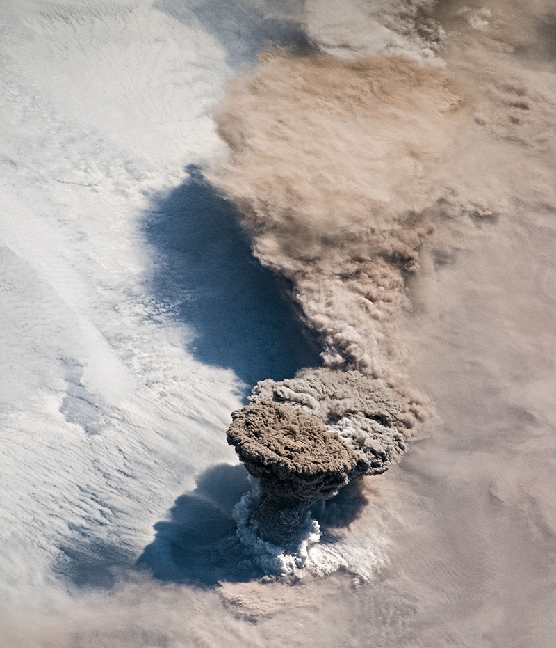
In the Kuril Islands there was a short-term, but powerful eruption of the volcano, which was accompanied by a large discharge of ash to a height of 15 km. Almost no one noticed the eruption, except for a few crews of ships in the Pacific Ocean, but several spacecraft could see this event from space. The ash trail of the volcano is a convenient occasion to get acquainted with the available means of monitoring the Earth.
Many meteorological satellites created by the largest space agencies are looking at our planet. Many of the results of their shooting are open to general use, and anyone can look at our common house from different angles and from different heights.
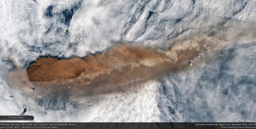
The European satellite Sentinel-3 flies at an altitude of about 800 km and shoots with a resolution of about 300 meters. His frame allows you to imagine the scale of the event.
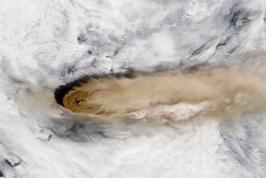
Similarly, only a little later, the American satellite Terra took off the Raikoke volcano . Its flight altitude is about 670 km, and the resolution of images is up to 250 meters.
Russia has a series of Meteor-M satellites, but the data from them is available only upon request, or you need to set up your own receiving station . There are still devices of the Resource and Canopus series, but they also need a request. Roscosmos open data geoportal does not seem to be updated, at least there weren’t a single snapshot from June 22nd.
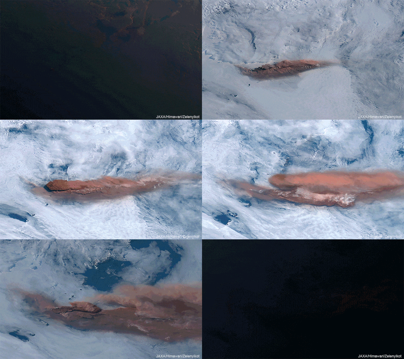
Much higher around the Earth, other meteorological satellites revolve – geostationary. At an altitude of about 36 thousand km, a satellite flying in the equatorial plane makes one revolution around the planet in 24 hours, i.e. it is always above the same point on the surface of the earth. This opportunity is often used by telecommunication and broadcasting companies, but there are also weather satellites there. Being in various “points of standing” they survey the planet each on its own side and are shooting with high frequency. So the Japanese satellite Himawari-8 is located in the most convenient place for observing the eruptions in the Kuril Islands.
Thanks to shooting with a period of 10 min, it is possible to see the entire process of eruption in a day.
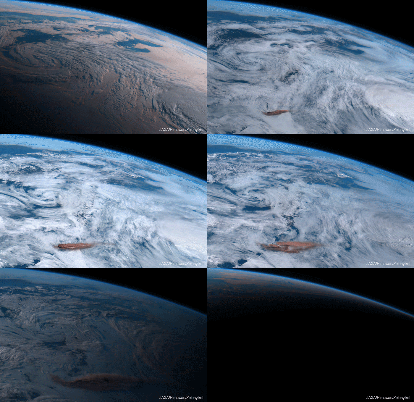
Himawari-8 image resolution is 500 meters.
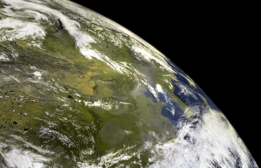
Russia also has one meteorological satellite in geostationary orbit – Electro-L2. The data from it is in the public domain , but, unfortunately, the recent eruption did not fall into the area of the survey.
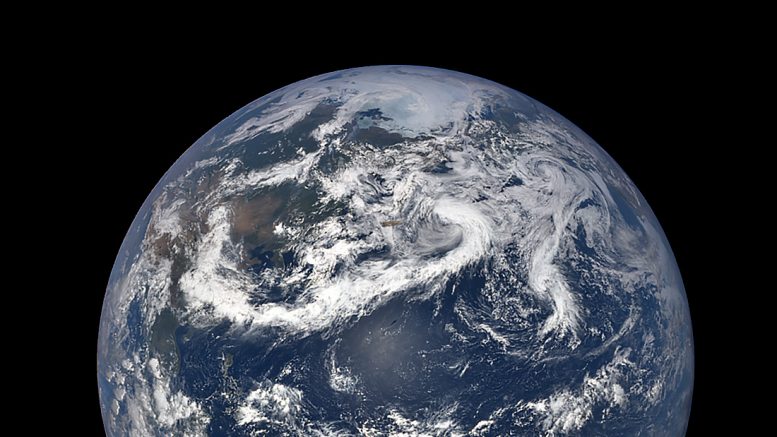
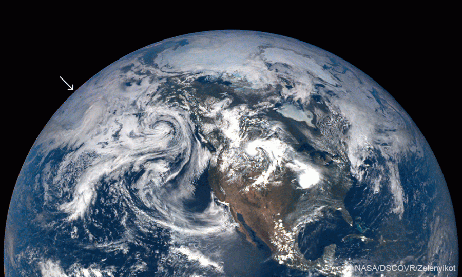
The most incredible thing is that this eruption turned out to be visible even from a distance of 1.5 million km from the Earth – it is four times farther than the moon. From this distance, the NASA camera on the DSCOVR satellite looks at our planet, its telescope always observes our planet from the illuminated side. The device is located between the Earth and the Sun in the so-called ” Lagrange point .”
Of course, these are far from all the satellites that capture the Earth. There are many spacecraft that observe with a much higher resolution of images, of their frames are Google and Yandex maps, they are used by military and civilian public services. But, as a rule, such satellites work according to a pre-written program, not for free, and remove only what they order, and events such as short-term volcanic eruptions do not fall into their program.
This eruption was also removed by the crew of the International Space Station.
